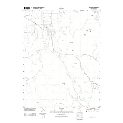
2012 Map of Kelseyville
USGS Topo · Published 2012About this map
Kelseyville serves as the central hub of this Lake County landscape, where the flat agricultural terrain of Big Valley meets the dramatic volcanic slopes of Mount Konocti. The map reflects a deeply rooted ranching and viticultural economy, evidenced by the Konoti Winery to the northwest and several named holdings including the McIntire Ranch and Mahnke Ranch. Water is the defining lifeblood of the region, with Kelsey Creek and Cole Creek carving paths through the foothills toward the basin. High-elevation features like Wright Peak and South Peak provide a stark contrast to the valleys below, while smaller water bodies like Boggs Lake and Little Borax Lake dot the more remote elevations. The network of rural roads, such as Bottle Rock Road and Glenbrook Road, connects these scattered settlements and agricultural outposts across the varied terrain.
Find a feature on this map
73 named features on this map. Tap any name to fly to it.
Don’t see what you’re looking for? This feature index may not catch every label — zoom into the map to look around manually.
Map Details
Editions of this 2012 Kelseyville Map
This is the sole edition of this map. No revisions or reprints were ever made.
Other maps of this area

1921 · Kelseyville
USGS Topo · 1:62,500

1924 · Bartlett Springs
USGS Topo · 1:62,500

1938 · Lakeport
USGS Topo · 1:62,500

1942 · Bartlett Springs
USGS Topo · 1:62,500

1943 · Kelseyville
USGS Topo · 1:62,500

1944 · Bartlett Springs
USGS Topo · 1:62,500

1945 · Lower Lake
USGS Topo · 1:62,500

1947 · Santa Rosa
USGS Topo · 1:250,000

1949 · Santa Rosa
USGS Topo · 1:250,000

1951 · Lakeport
USGS Topo · 1:62,500