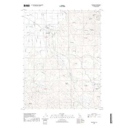
2018 Map of Kelseyville
USGS Topo · Published 2018About this map
Kelseyville sits as the primary settlement in this northern California landscape, surrounded by an intricate network of waterways and complex volcanic terrain. The agricultural and residential layout of the town is anchored by Main St and Church St, while the Kelseyville Cem and a Po serve as local landmarks for family researchers. To the east, the topography rises sharply toward the heights of Mt Konocit Wright Peak and Buckingham Bluffs, overlooking the drainage of Kelsey Cr. The map reveals a transition from the valley floor into the southern highlands of the Mayacmas Mountains. Unusual features like Boggs Lake, perched at a higher elevation, and isolated water sources such as Carlsbad Spring suggest a geologically active environment. Smaller settlements like Glenview appear near the southeastern limits, tucked away near Mt Hannah and the winding course of Wildcat Rd.
Find a feature on this map
93 named features on this map. Tap any name to fly to it.
Don’t see what you’re looking for? This feature index may not catch every label — zoom into the map to look around manually.
Map Details
Editions of this 2018 Kelseyville Map
This is the sole edition of this map. No revisions or reprints were ever made.
Other maps of this area

1921 · Kelseyville
USGS Topo · 1:62,500

1924 · Bartlett Springs
USGS Topo · 1:62,500

1938 · Lakeport
USGS Topo · 1:62,500

1942 · Bartlett Springs
USGS Topo · 1:62,500

1943 · Kelseyville
USGS Topo · 1:62,500

1944 · Bartlett Springs
USGS Topo · 1:62,500

1945 · Lower Lake
USGS Topo · 1:62,500

1947 · Santa Rosa
USGS Topo · 1:250,000

1949 · Santa Rosa
USGS Topo · 1:250,000

1951 · Lakeport
USGS Topo · 1:62,500