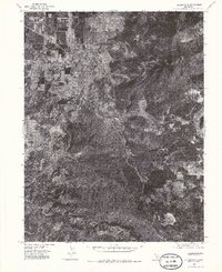
1974 Map of Kelseyville
USGS Topo · Published 1979About this map
Kelseyville serves as the central hub of this Lake County orthophotomap, showing the town's footprint as it appeared in the late 1970s. This aerial perspective, captured by the Geological Survey, reveals the intricate relationship between the agricultural valley floor and the surrounding upland terrain. The drainage patterns of Adobe Creek and Cole Creek define the local topography, carving through the landscape toward the clearings that surround the residential developments of Buckingham. To the southeast, the distinct natural feature of Boggs Lake stands out against the wooded slopes, providing a clear reference point for land-use changes and environmental shifts in the area during this period of California's history.
Find a feature on this map
5 named features on this map. Tap any name to fly to it.
Don’t see what you’re looking for? This feature index may not catch every label — zoom into the map to look around manually.
Map Details
Editions of this 1974 Kelseyville Map
2 editions found
Other maps of this area

1921 · Kelseyville
USGS Topo · 1:62,500

1924 · Bartlett Springs
USGS Topo · 1:62,500

1938 · Lakeport
USGS Topo · 1:62,500

1942 · Bartlett Springs
USGS Topo · 1:62,500

1943 · Kelseyville
USGS Topo · 1:62,500

1944 · Bartlett Springs
USGS Topo · 1:62,500

1945 · Lower Lake
USGS Topo · 1:62,500

1947 · Santa Rosa
USGS Topo · 1:250,000

1949 · Santa Rosa
USGS Topo · 1:250,000

1951 · Lakeport
USGS Topo · 1:62,500