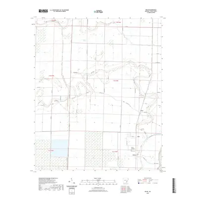
2020 Map of Kelso
USGS Topo · Published 2020About this map
Rohwer and the surrounding agricultural lowlands of Desha County are defined by a complex network of bayous and drainage canals that manage the wet landscape. The Rohwer Relocation Center Cem stands as a significant historical landmark, preserving the memory of the World War II-era internment camp established in this delta region. Nearby, Memorial Cem and Kelso Cem provide further points of interest for genealogists tracing local families.
Find a feature on this map
57 named features on this map. Tap any name to fly to it.
Don’t see what you’re looking for? This feature index may not catch every label — zoom into the map to look around manually.
Map Details
Editions of this 2020 Kelso Map
This is the sole edition of this map. No revisions or reprints were ever made.
Other maps of this area

1933 · Lamont
USGS Topo · 1:62,500

1935 · Red Fork
USGS Topo · 1:62,500

1936 · McGehee
USGS Topo · 1:62,500

1937 · McGehee
USGS Topo · 1:62,500

1939 · Big Island
USGS Topo · 1:62,500

1939 · Lamont
USGS Topo · 1:62,500

1953 · Greenwood
USGS Topo · 1:250,000

1955 · McGehee
USGS Topo · 1:62,500

1956 · Greenwood
USGS Topo · 1:250,000
1969 · Winchester
USGS Topo · 1:24,000