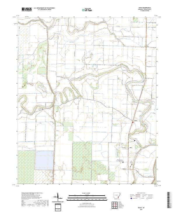
2024 Map of Kelso
USGS Topo · Published 2024About this map
Rohwer Relocation Center Memorial Cem stands as a somber landmark within this Delta landscape, marking a site of significant mid-century history near the settlement of Rohwer. The terrain is defined by the winding course of Amos Bayou and the expansive wetlands of the Felsenthal National Wildlife Refuge, which dominates the western portion of the quadrangle. Agricultural drainage is evident through features like Canal Number 81, supporting the rural economy that connects the small communities of Kelso and Duce. The presence of several family or community burial sites, including Rolling Water Cem, Kelso Cem, and Oak Grove Cem, provides vital points of interest for those tracing local family lineages. Modern preservation and recreation efforts are visible in the Delta Heritage Trl, which follows the old rail corridors through the flat bottomlands.
Find a feature on this map
58 named features on this map. Tap any name to fly to it.
Don’t see what you’re looking for? This feature index may not catch every label — zoom into the map to look around manually.
Map Details
Editions of this 2024 Kelso Map
This is the sole edition of this map. No revisions or reprints were ever made.
Other maps of this area

1933 · Lamont
USGS Topo · 1:62,500

1935 · Red Fork
USGS Topo · 1:62,500

1936 · McGehee
USGS Topo · 1:62,500

1937 · McGehee
USGS Topo · 1:62,500

1939 · Big Island
USGS Topo · 1:62,500

1939 · Lamont
USGS Topo · 1:62,500

1953 · Greenwood
USGS Topo · 1:250,000

1955 · McGehee
USGS Topo · 1:62,500

1956 · Greenwood
USGS Topo · 1:250,000
1969 · Winchester
USGS Topo · 1:24,000