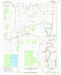
1969 Map of Kelso
USGS Topo · Published 1971About this map
The alluvial lowlands of Desha County are defined here by the winding course of Amos Bayou and the straight tracks of the Missouri Pacific railroad. This landscape, surveyed in the late 1960s, reveals a highly managed agricultural environment where numerous wells and flumes support local industry, alongside a large Reservoir and multiple fish farms. The settlement of Rohwer serves as a local hub, situated near the Oak Grove Cem Ch and a significant Indian Mound, pointing to a long history of human habitation on these Delta lands.
Find a feature on this map
21 named features on this map. Tap any name to fly to it.
Don’t see what you’re looking for? This feature index may not catch every label — zoom into the map to look around manually.
Map Details
Editions of this 1969 Kelso Map
This is the sole edition of this map. No revisions or reprints were ever made.
Other maps of this area

1933 · Lamont
USGS Topo · 1:62,500

1935 · Red Fork
USGS Topo · 1:62,500

1936 · McGehee
USGS Topo · 1:62,500

1937 · McGehee
USGS Topo · 1:62,500

1939 · Big Island
USGS Topo · 1:62,500

1939 · Lamont
USGS Topo · 1:62,500

1953 · Greenwood
USGS Topo · 1:250,000

1955 · McGehee
USGS Topo · 1:62,500

1956 · Greenwood
USGS Topo · 1:250,000
1969 · Winchester
USGS Topo · 1:24,000