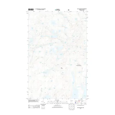
2013 Map of Kelso Mountain
USGS Topo · Published 2013About this map
Superior National Forest encompasses this glacial landscape in the eastern Arrowhead region of Minnesota. The terrain is defined by a dense network of interconnected waterways and basins, most notably Kelso Mountain and the winding Frost River. This 2013 survey illustrates a wilderness nearly devoid of modern infrastructure, where the hydrology dictates the geography. Dozens of small, uniquely named water bodies like Lawless Lake, Afton Lake, and Bologna Lake are scattered across the quadrangle, reflecting the intricate lake-and-portage systems typical of this northern forest. The map serves as a contemporary record of these primitive landscapes, detailing the fine contours around Mesaba Lake and the various drainages that feed into the larger regional watershed. Researchers can trace the specific boundaries of protected lands and the orientation of natural features such as Intersection Lake and Pencil Lake.
Find a feature on this map
68 named features on this map. Tap any name to fly to it.
Don’t see what you’re looking for? This feature index may not catch every label — zoom into the map to look around manually.
Map Details
Editions of this 2013 Kelso Mountain Map
This is the sole edition of this map. No revisions or reprints were ever made.
Other maps of this area

1954 · Two Harbors
USGS Topo · 1:250,000

1957 · Two Harbors
USGS Topo · 1:250,000

1957 · Quetico
USGS Topo · 1:250,000

1958 · Two Harbors
USGS Topo · 1:250,000

1959 · Ogishkemuncie Lake
USGS Topo · 1:24,000

1959 · Gillis Lake
USGS Topo · 1:24,000

1960 · Lake Polly
USGS Topo · 1:24,000

1960 · Kawishiwi Lake
USGS Topo · 1:24,000

1960 · Sawbill Camp
USGS Topo · 1:24,000

1960 · Beth Lake
USGS Topo · 1:24,000