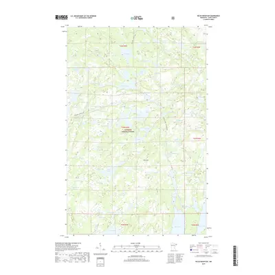
2019 Map of Kelso Mountain
USGS Topo · Published 2019About this map
Superior National Forest encompasses this entire northern landscape, defined by a dense network of interconnected waterways and portage routes within the Boundary Waters region. This 2019 survey documents the intricate geography of lakes such as Mesaba Lake, Zenith Lake, and Wine Lake, which are linked by established trails like the Zenith Lake - Lujenida Lake and Bug Lake - Louse Lake paths. These routes reflect the long-standing transport patterns of the region, where travel is dictated by the passage between basins.
Find a feature on this map
70 named features on this map. Tap any name to fly to it.
Don’t see what you’re looking for? This feature index may not catch every label — zoom into the map to look around manually.
Map Details
Editions of this 2019 Kelso Mountain Map
This is the sole edition of this map. No revisions or reprints were ever made.
Other maps of this area

1954 · Two Harbors
USGS Topo · 1:250,000

1957 · Two Harbors
USGS Topo · 1:250,000

1957 · Quetico
USGS Topo · 1:250,000

1958 · Two Harbors
USGS Topo · 1:250,000

1959 · Ogishkemuncie Lake
USGS Topo · 1:24,000

1959 · Gillis Lake
USGS Topo · 1:24,000

1960 · Lake Polly
USGS Topo · 1:24,000

1960 · Kawishiwi Lake
USGS Topo · 1:24,000

1960 · Sawbill Camp
USGS Topo · 1:24,000

1960 · Beth Lake
USGS Topo · 1:24,000