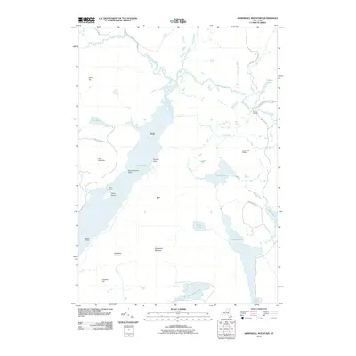
2010 Map of Kempshall Mountain
USGS Topo · Published 2010About this map
Kempshall Mountain stands as a central landmark in this Adirondack landscape, which is defined by the expansive waters of Long Lake and the winding course of the Raquette River. The geography reflects a wilderness corridor where water and topography dictated movement, evidenced by the Northville-Lake Placid Trl cutting through the northeast. Isolated outposts like Island House and Shattuck Clearing appear alongside family or locally named points such as Plumley Point and Kelly Point.
Find a feature on this map
38 named features on this map. Tap any name to fly to it.
Don’t see what you’re looking for? This feature index may not catch every label — zoom into the map to look around manually.
Map Details
Editions of this 2010 Kempshall Mountain Map
This is the sole edition of this map. No revisions or reprints were ever made.
Other maps of this area

1898 · Newcomb
USGS Topo · 1:62,500

1901 · Newcomb
USGS Topo · 1:62,500

1903 · Blue Mountain
USGS Topo · 1:62,500

1904 · Santanoni
USGS Topo · 1:62,500

1904 · Long Lake
USGS Topo · 1:62,500

1948 · Ogdensburg
USGS Topo · 1:250,000

1950 · Utica
USGS Topo · 1:250,000

1951 · Ogdensburg
USGS Topo · 1:250,000

1953 · Ogdensburg
USGS Topo · 1:250,000

1953 · Santanoni
USGS Topo · 1:62,500