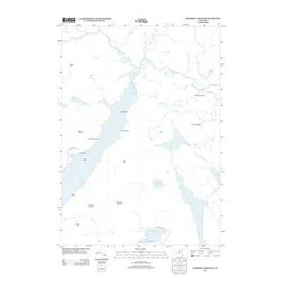
2013 Map of Kempshall Mountain
USGS Topo · Published 2013About this map
Long Lake dominates the western portion of this 2013 survey, serving as a central drainage point for the high Adirondack interior. The landscape is defined by the winding course of the Raquette River and the Cold River, which converge in a network of ponds and marshes including Latham Pond and First Pond. Named high points like Kempshall Mountain, Spruce Top, and Blueberry Mountain provide the vertical relief for this densely forested region. Remote outposts and seasonal sites such as Shattuck Clearing, Island House, and Camp Islands indicate the limited human footprint in this wilderness area. Local travel ways like Langley Park Way and the curiously named Coffee Pot Turn offer insights into the modern management of this backcountry, while traditional water routes like the Wolf Pond Outlet connect larger bodies such as Catlin Lake to the broader regional watershed.
Find a feature on this map
33 named features on this map. Tap any name to fly to it.
Don’t see what you’re looking for? This feature index may not catch every label — zoom into the map to look around manually.
Map Details
Editions of this 2013 Kempshall Mountain Map
This is the sole edition of this map. No revisions or reprints were ever made.
Other maps of this area

1898 · Newcomb
USGS Topo · 1:62,500

1901 · Newcomb
USGS Topo · 1:62,500

1903 · Blue Mountain
USGS Topo · 1:62,500

1904 · Santanoni
USGS Topo · 1:62,500

1904 · Long Lake
USGS Topo · 1:62,500

1948 · Ogdensburg
USGS Topo · 1:250,000

1950 · Utica
USGS Topo · 1:250,000

1951 · Ogdensburg
USGS Topo · 1:250,000

1953 · Ogdensburg
USGS Topo · 1:250,000

1953 · Santanoni
USGS Topo · 1:62,500