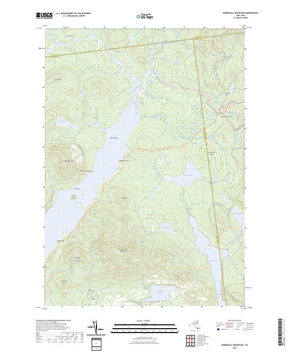
2023 Map of Kempshall Mountain
USGS Topo · Published 2023About this map
Kempshall Mountain dominates this portion of the Adirondack Park, where high elevations meet a complex network of waterways at the tri-county boundary of Hamilton, Franklin, and Essex. The landscape is defined by the long reach of Long Lake and the Raquette River, punctuated by isolated landmarks like Island House and Plumley Point. The map traces a significant section of the Northville-Placid Trl, a corridor that connects remote points like Shattuck Clearing and Kelly Point. This modern survey records the enduring wilderness character of the region, showing how contemporary trails like the Cold River Horse Trl follow the same drainage patterns of Moose Creek and Cold River that have shaped travel through these mountains for generations. From the heights of Blueberry Mountain to the shores of Catlin Lake, the map provides a precise look at the drainage and topography of this interior wilderness.
Find a feature on this map
40 named features on this map. Tap any name to fly to it.
Don’t see what you’re looking for? This feature index may not catch every label — zoom into the map to look around manually.
Map Details
Editions of this 2023 Kempshall Mountain Map
This is the sole edition of this map. No revisions or reprints were ever made.
Other maps of this area

1898 · Newcomb
USGS Topo · 1:62,500

1901 · Newcomb
USGS Topo · 1:62,500

1903 · Blue Mountain
USGS Topo · 1:62,500

1904 · Santanoni
USGS Topo · 1:62,500

1904 · Long Lake
USGS Topo · 1:62,500

1948 · Ogdensburg
USGS Topo · 1:250,000

1950 · Utica
USGS Topo · 1:250,000

1951 · Ogdensburg
USGS Topo · 1:250,000

1953 · Ogdensburg
USGS Topo · 1:250,000

1953 · Santanoni
USGS Topo · 1:62,500