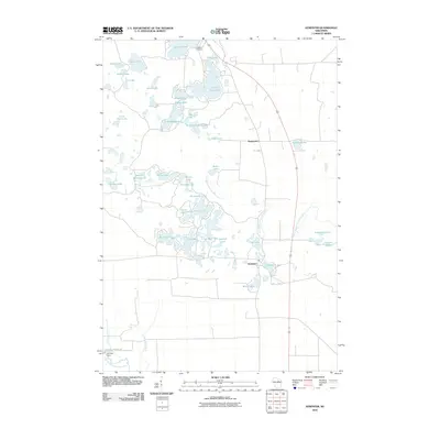
2010 Map of Kempster
USGS Topo · Published 2010About this map
Kempster and Koepenick serve as the primary nodes of human settlement in this lake-rich pocket of Langlade County. The landscape is defined by a dense concentration of glacial water bodies, ranging from the prominent Greater Bass Lake and Summit Lake in the north to the smaller, descriptive Shoestring Lake and Snag Lake in the interior. This region is a complex hydrologic network, where the East Branch Eau Claire River meanders south toward the Ormsby Dam. Local history and genealogy interests are centered around Lakeside Cemetery, positioned near the northern lakes. The distribution of lakes like Water Power Lake and Deep Wood Lake suggests a region historically shaped by both natural resources and seasonal recreation. The map meticulously records the numerous smaller basins, such as Alga Lake and Susan Lake, which characterize the glacial drift topography of northern Wisconsin.
Find a feature on this map
45 named features on this map. Tap any name to fly to it.
Don’t see what you’re looking for? This feature index may not catch every label — zoom into the map to look around manually.
Map Details
Editions of this 2010 Kempster Map
This is the sole edition of this map. No revisions or reprints were ever made.
Other maps of this area

1899 · Wausau
USGS Topo · 1:125,000

1902 · Wausau
USGS Topo · 1:125,000

1940 · Parrish
USGS Topo · 1:48,000

1942 · Elcho
USGS Topo · 1:48,000

1950 · Elcho
USGS Topo · 1:48,000

1950 · Parrish
USGS Topo · 1:48,000

1951 · Doering
USGS Topo · 1:48,000

1952 · Parrish
USGS Topo · 1:48,000

1952 · Antigo
USGS Topo · 1:48,000

1954 · Iron Mountain
USGS Topo · 1:250,000