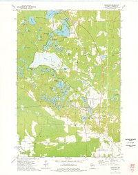
1973 Map of Kempster
USGS Topo · Published 1977About this map
Kempster and the surrounding township of Upham are defined by a complex mosaic of glacial kettle lakes and wetlands during the early 1970s. The Chicago and North Western railroad forms the central corridor for the local economy, connecting the small settlements of Koepenick and Lakeside. The landscape is dominated by large water bodies such as Summit Lake and Greater Bass Lake, the latter hosting the Bass Lake Country Club, reflecting a shift toward recreational land use in the Northwoods.
Find a feature on this map
59 named features on this map. Tap any name to fly to it.
Don’t see what you’re looking for? This feature index may not catch every label — zoom into the map to look around manually.
Map Details
Editions of this 1973 Kempster Map
This is the sole edition of this map. No revisions or reprints were ever made.
Other maps of this area

1899 · Wausau
USGS Topo · 1:125,000

1902 · Wausau
USGS Topo · 1:125,000

1940 · Parrish
USGS Topo · 1:48,000

1942 · Elcho
USGS Topo · 1:48,000

1950 · Elcho
USGS Topo · 1:48,000

1950 · Parrish
USGS Topo · 1:48,000

1951 · Doering
USGS Topo · 1:48,000

1952 · Parrish
USGS Topo · 1:48,000

1952 · Antigo
USGS Topo · 1:48,000

1954 · Iron Mountain
USGS Topo · 1:250,000