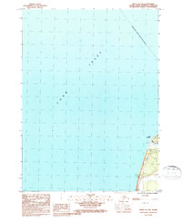
1987 Map of Kenai A-5 SW
USGS Topo · Published 1987About this map
Cook Inlet dominates this coastal survey, where the waters meet the southwestern edge of the Kenai Peninsula. The settlement of Ninilchik sits at the base of the map near the shoreline, positioned just south of the prominent Cape Ninilchik. This area serves as a primary point of access to the marine environment, evidenced by the presence of a Campground and a Radio Tower near the coast.
Find a feature on this map
8 named features on this map. Tap any name to fly to it.
Don’t see what you’re looking for? This feature index may not catch every label — zoom into the map to look around manually.
Map Details
Editions of this 1987 Kenai A-5 SW Map
This is the sole edition of this map. No revisions or reprints were ever made.
Other maps of this area

1944 · Kenai
USGS Topo · 1:250,000

1946 · Seldovia D-5
USGS Topo · 1:63,360

1950 · Kenai
USGS Topo · 1:250,000

1951 · Seldovia D-5
USGS Topo · 1:63,360

1951 · Seldovia
USGS Topo · 1:250,000

1951 · Kenai A-5
USGS Topo · 1:63,360

1952 · Kenai A-5
USGS Topo · 1:63,360

1958 · Kenai
USGS Topo · 1:250,000
1961 · Seldovia D-5
USGS Topo · 1:63,360

1963 · Seldovia
USGS Topo · 1:250,000