
1951 Map of Kenai A-5
USGS Topo · Published 1960About this map
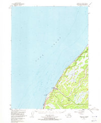
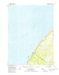
Cook Inlet dominates the western half of this survey, defining the rugged shoreline of the Kenai Peninsula in the early 1950s. The landscape is primarily shaped by the drainage patterns of the Ninilchik River and Deep Creek, which flow through heavily forested and marshy terrain toward the coast. Human presence is concentrated along the newly established Sterling Highway, which parallels the coast and provides the primary artery for local travel and transport.
Find a feature on this map
14 named features on this map. Tap any name to fly to it.
Don’t see what you’re looking for? This feature index may not catch every label — zoom into the map to look around manually.
Map Details
Editions of this 1951 Kenai A-5 Map
3 editions found
Other maps of this area

1944 · Kenai
USGS Topo · 1:250,000

1946 · Seldovia D-5
USGS Topo · 1:63,360

1949 · Seldovia D-4
USGS Topo · 1:63,360

1950 · Kenai
USGS Topo · 1:250,000

1951 · Seldovia D-5
USGS Topo · 1:63,360

1951 · Seldovia D-4
USGS Topo · 1:63,360

1951 · Seldovia
USGS Topo · 1:250,000

1951 · Kenai B-4
USGS Topo · 1:63,360

1951 · Kenai A-4
USGS Topo · 1:63,360

1952 · Kenai A-5
USGS Topo · 1:63,360