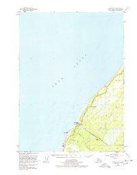
1951 Map of Kenai A-5
USGS Topo · Published 1978About this map
Cook Inlet dominates the western landscape of this mid-century survey, where the waters of the Kenai Peninsula meet a shoreline defined by Cape Ninilchik. The settlement of Ninilchik serves as the primary hub of activity, situated where the Ninilchik River and Deep Creek reach the coast. The mapping reflects a period of infrastructure development along the Sterling Highway, showing early aviation and transportation footprints like the Ninilchik Landing Strip and Ninilchik Road.
Find a feature on this map
17 named features on this map. Tap any name to fly to it.
Don’t see what you’re looking for? This feature index may not catch every label — zoom into the map to look around manually.
Map Details
Editions of this 1951 Kenai A-5 Map
3 editions found
Other maps of this area

1944 · Kenai
USGS Topo · 1:250,000

1946 · Seldovia D-5
USGS Topo · 1:63,360

1949 · Seldovia D-4
USGS Topo · 1:63,360

1950 · Kenai
USGS Topo · 1:250,000

1951 · Seldovia D-5
USGS Topo · 1:63,360

1951 · Seldovia D-4
USGS Topo · 1:63,360

1951 · Seldovia
USGS Topo · 1:250,000

1951 · Kenai A-5
USGS Topo · 1:63,360

1951 · Kenai B-4
USGS Topo · 1:63,360

1951 · Kenai A-4
USGS Topo · 1:63,360