1951 Map of Kenai A-4
USGS Topo · Published 1974About this map
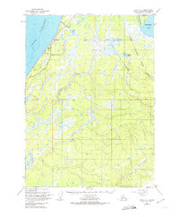
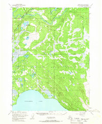
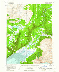
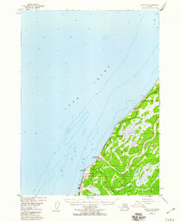
Clam Gulch sits perched above Cook Inlet along the western edge of the Kenai Peninsula, marking a small pocket of coastal settlement during the early 1950s. The inland landscape is dominated by the sprawling Kenai National Moose Range, an area defined by its complex drainage systems and myriad small lakes. The Sterling Highway serves as the primary artery through this territory, connecting the coastal bluffs to the interior wilderness. This period shows a rugged terrain where industry is minimal, evidenced only by a lone Gravel Pit near the coast.
Find a feature on this map
17 named features on this map. Tap any name to fly to it.
Don’t see what you’re looking for? This feature index may not catch every label — zoom into the map to look around manually.
Map Details
Editions of this 1951 Kenai A-4 Map
2 editions found

Other maps of this area

1944 · Kenai
USGS Topo · 1:250,000

1946 · Seldovia D-5
USGS Topo · 1:63,360

1949 · Seldovia D-4
USGS Topo · 1:63,360

1950 · Kenai
USGS Topo · 1:250,000
1950 · Kenai B-3
USGS Topo · 1:63,360

1951 · Seldovia D-5
USGS Topo · 1:63,360

1951 · Seldovia D-4
USGS Topo · 1:63,360

1951 · Seldovia
USGS Topo · 1:250,000
1951 · Seldovia D-3
USGS Topo · 1:63,360
1951 · Kenai A-5
USGS Topo · 1:63,360