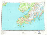
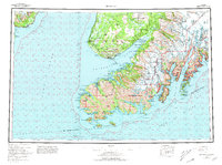
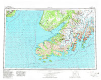
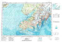
1963 Map of Seldovia
USGS Topo · Published 1967About this map
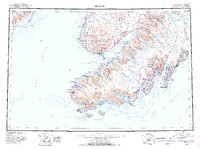
Seldovia and the Indian Village sit at the entrance to Kachemak Bay, anchoring a coastal landscape where the maritime economy meets the massive ice fields of the Kenai Peninsula. Compiled in the early 1960s, this survey shows the expansion of the Sterling Highway as it reaches its southern terminus at Homer, linking the remote settlements of Happy Valley and Anchor Point to the rest of the state. Across the water, the terrain is dominated by the massive flows of the Grewingk Glacier, Petrof Glacier, and Chernof Glacier, which carve the shoreline into a complex network of deep-water fjords like Sadie Cove and Tutka Bay. The map also captures the Kenai National Moose Range in its mid-century state, alongside the isolated outposts at English Bay and Port Graham that remained accessible primarily by sea.
Find a feature on this map
93 named features on this map. Tap any name to fly to it.
Don’t see what you’re looking for? This feature index may not catch every label — zoom into the map to look around manually.
Map Details
Editions of this 1963 Seldovia Map
5 editions found