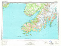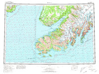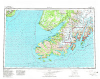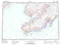
1963 Map of Seldovia
USGS Topo · Published 1985About this map
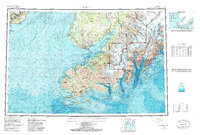
Seldovia and the surrounding coastline of the southern Kenai Peninsula are documented here during a period of transition, following the 1964 earthquake and prior to the large-scale expansion of the regional tourism industry. The map captures the established seafaring and fishing hubs of Homer and Kachemak City, alongside the coastal settlements of Port Graham and English Bay. Inland, the topographic detail reveals the massive ice-and-rock landscape of the Harding Icefield, which feeds a complex system of glaciers including Grewingk Glacier and McCarty Glacier.
Find a feature on this map
117 named features on this map. Tap any name to fly to it.
Don’t see what you’re looking for? This feature index may not catch every label — zoom into the map to look around manually.
Map Details
Editions of this 1963 Seldovia Map
5 editions found