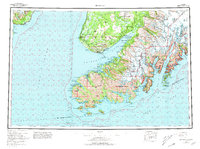
1963 Map of Seldovia
USGS Topo · Published 1981About this map
Kachemak Bay serves as the central focal point of this coastal Alaska survey, revealing a landscape defined by the intersection of sea and ice. At the head of the bay, the Grewingk Glacier flows toward Halibut Cove Lagoon, while the southern reaches of the Kenai Peninsula are dotted with small, isolated settlements. The map highlights the early development of Homer near Bluff Point and the remote villages of English Bay and Port Graham situated along the southwestern coastline.
Find a feature on this map
165 named features on this map. Tap any name to fly to it.
Don’t see what you’re looking for? This feature index may not catch every label — zoom into the map to look around manually.
Map Details
Editions of this 1963 Seldovia Map
5 editions found

Other maps of this area

1944 · Kenai
USGS Topo · 1:250,000

1946 · Blying Sound
USGS Topo · 1:250,000

1946 · Lake Clark
USGS Topo · 1:250,000

1946 · Seldovia C-5
USGS Topo · 1:63,360

1946 · Seldovia D-5
USGS Topo · 1:63,360

1948 · Seldovia C-4
USGS Topo · 1:63,360

1949 · Iliamna C-1
USGS Topo · 1:63,360

1949 · Seldovia C-4
USGS Topo · 1:62,500

1949 · Seldovia D-4
USGS Topo · 1:63,360

1950 · Kenai
USGS Topo · 1:250,000