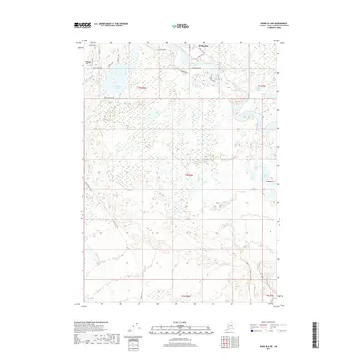
2017 Map of Kenai B-2 NW
USGS Topo · Published 2017About this map
The Kenai River winds through the northern portion of this landscape, supporting the community of Sterling and several riverside access points like Fishermans Road and Kenai Keys Road. The map reveals a dense network of local connector roads and residential tracks north of the river, while the southern expanse is dominated by wetlands and complex lake systems. Notable water bodies such as Browns Lake, Hunters Lake, and Sahot Lake are interspersed among unnamed ponds and glacial terrain.
Find a feature on this map
31 named features on this map. Tap any name to fly to it.
Don’t see what you’re looking for? This feature index may not catch every label — zoom into the map to look around manually.
Map Details
Editions of this 2017 Kenai B-2 NW Map
This is the sole edition of this map. No revisions or reprints were ever made.
Other maps of this area

1944 · Kenai
USGS Topo · 1:250,000

1950 · Kenai
USGS Topo · 1:250,000

1950 · Kenai C-3
USGS Topo · 1:63,360

1950 · Kenai B-3
USGS Topo · 1:63,360

1951 · Kenai B-2
USGS Topo · 1:63,360

1951 · Kenai C-2
USGS Topo · 1:63,360

1951 · Kenai C-3
USGS Topo · 1:63,360

1952 · Kenai C-2
USGS Topo · 1:63,360

1952 · Kenai B-3
USGS Topo · 1:63,360

1952 · Kenai B-2
USGS Topo · 1:63,360