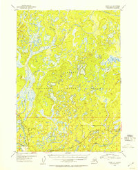
1952 Map of Kenai C-3
USGS Topo · Published 1954About this map
The Kenai National Moose Range dominates this 1950s landscape, characterized by a dense network of lakes and marshes typical of the central Kenai Peninsula before the surge of modern development. The Sterling Highway provides a primary corridor through the southern portion of the sheet, connecting early outposts like Naptowne and the growing junction of Soldotna. The survey captures a moment of early Alaskan settlement along the Kenai River, marked by isolated cabins and a few established public points like a Campground and a Gravel Pit.
Find a feature on this map
18 named features on this map. Tap any name to fly to it.
Don’t see what you’re looking for? This feature index may not catch every label — zoom into the map to look around manually.
Map Details
Editions of this 1952 Kenai C-3 Map
This is the sole edition of this map. No revisions or reprints were ever made.
Other maps of this area

1944 · Kenai
USGS Topo · 1:250,000

1950 · Kenai
USGS Topo · 1:250,000

1950 · Kenai C-3
USGS Topo · 1:63,360

1950 · Kenai B-3
USGS Topo · 1:63,360

1950 · Kenai D-4
USGS Topo · 1:63,360

1951 · Kenai D-3
USGS Topo · 1:63,360

1951 · Kenai B-2
USGS Topo · 1:63,360

1951 · Kenai C-2
USGS Topo · 1:63,360

1951 · Kenai D-2
USGS Topo · 1:63,360

1951 · Kenai C-4
USGS Topo · 1:63,360