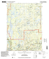
1992 Map of Kenai C-3
USGS Topo · Published 2002About this map
Sterling and the northern outskirts of Soldotna anchor the southern reach of this landscape, where the Sterling Highway serves as the primary artery through the Kenai National Wildlife Refuge. The map reveals a dense network of industrial and recreational activity, most notably the Swanson River Oil Field in the north and numerous Gravel Pits and Oil Wells scattered across the borough. The hydrology of the Kenai Peninsula is on full display, with a staggering concentration of named water bodies from the large Shadura Lake and Sevena Lake to the smaller Whisper Lake and Cisco Lake.
Find a feature on this map
83 named features on this map. Tap any name to fly to it.
Don’t see what you’re looking for? This feature index may not catch every label — zoom into the map to look around manually.
Map Details
Editions of this 1992 Kenai C-3 Map
This is the sole edition of this map. No revisions or reprints were ever made.
Other maps of this area

1944 · Kenai
USGS Topo · 1:250,000

1950 · Kenai
USGS Topo · 1:250,000

1950 · Kenai C-3
USGS Topo · 1:63,360

1950 · Kenai B-3
USGS Topo · 1:63,360

1950 · Kenai D-4
USGS Topo · 1:63,360

1951 · Kenai D-3
USGS Topo · 1:63,360

1951 · Kenai B-2
USGS Topo · 1:63,360

1951 · Kenai C-2
USGS Topo · 1:63,360

1951 · Kenai D-2
USGS Topo · 1:63,360

1951 · Kenai C-4
USGS Topo · 1:63,360