2014 Map of Kenai C-3 SE
USGS Topo · Published 2014About this map
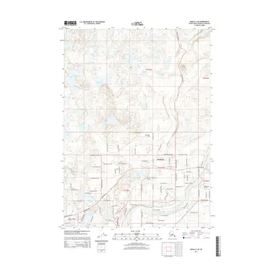
The settlement of Sterling serves as the central hub of this Kenai Peninsula landscape, situated where the Sterling Highway crosses the expansive Kenai River. The 2014 survey reveals a transportation network heavily influenced by aviation, with private facilities like the Dahler Homestead Airport, Scooter's Landing Strip Airport, and the Dutch Landing Strip dotting the residential and wilderness corridors. North of the town, the terrain is characterized by a dense concentration of water bodies including Sunken Island Lake, Gagara Lake, and Cow Lake, illustrating the post-glacial hydrology of the region. The confluence of the Moose River and the Kenai River defines the southeastern sector, a vital area for local recreation and river-based activity. Numerous local roads such as Robinson Loop Road and Scout Lake Road connect scattered residential developments to the surrounding lakefronts and riverbanks.
Find a feature on this map
84 named features on this map. Tap any name to fly to it.
Don’t see what you’re looking for? This feature index may not catch every label — zoom into the map to look around manually.
Map Details
Editions of this 2014 Kenai C-3 SE Map
This is the sole edition of this map. No revisions or reprints were ever made.
Other maps of this area

1944 · Kenai
USGS Topo · 1:250,000

1950 · Kenai
USGS Topo · 1:250,000

1950 · Kenai C-3
USGS Topo · 1:63,360

1950 · Kenai B-3
USGS Topo · 1:63,360

1951 · Kenai B-2
USGS Topo · 1:63,360

1951 · Kenai C-2
USGS Topo · 1:63,360

1951 · Kenai C-3
USGS Topo · 1:63,360

1952 · Kenai C-2
USGS Topo · 1:63,360

1952 · Kenai B-3
USGS Topo · 1:63,360

1952 · Kenai B-2
USGS Topo · 1:63,360