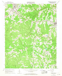
1966 Map of Kenbridge West
USGS Topo · Published 1968About this map
Victoria and Kenbridge anchor this mid-1960s survey of Lunenburg County, connected by the industrial corridor of the Norfolk And Western railroad. The landscape between these two primary settlements is defined by a high density of small rural communities and civic landmarks, including Oral Oaks and Sneads Corner. These pockets of habitation are frequently marked by local churches and family burial grounds, such as Mt Bethel Ch, Good Hope Ch, and Dinkes Cem, providing a precise record of the county's social geography before late-century modernization.
Find a feature on this map
28 named features on this map. Tap any name to fly to it.
Don’t see what you’re looking for? This feature index may not catch every label — zoom into the map to look around manually.
Map Details
Editions of this 1966 Kenbridge West Map
3 editions found
Other maps of this area

1891 · Farmville
USGS Topo · 1:125,000

1893 · Farmville
USGS Topo · 1:125,000

1947 · Roanoke
USGS Topo · 1:250,000

1953 · Greensboro
USGS Topo · 1:250,000

1954 · Greensboro
USGS Topo · 1:250,000

1955 · Chase City
USGS Topo · 1:62,500

1955 · Kenbridge
USGS Topo · 1:62,500

1958 · Crewe
USGS Topo · 1:62,500

1958 · Keysville
USGS Topo · 1:62,500

1959 · Roanoke
USGS Topo · 1:250,000