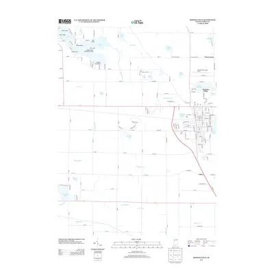
2013 Map of Kendallville
USGS Topo · Published 2013About this map
The glacial kettle lakes of Noble County define this Indiana landscape, with Sylvan Lake anchoring the northwestern corner. The map reveals a cluster of distinct islands within these waters, including Big Island, Bishop Island, and the curiously named Chicken Coop Island. This area serves as a primary drainage basin, where a complex network of man-made and natural waterways like Oviatt Ditch, Waterhouse Ditch, and Rimmell Branch connect numerous smaller basins such as Munk Lake and Wible Lake.
Find a feature on this map
160 named features on this map. Tap any name to fly to it.
Don’t see what you’re looking for? This feature index may not catch every label — zoom into the map to look around manually.
Map Details
Editions of this 2013 Kendallville Map
This is the sole edition of this map. No revisions or reprints were ever made.
Other maps of this area

1942 · Stroh
USGS Topo · 1:24,000

1947 · Wolcottville
USGS Topo · 1:24,000

1947 · Oliver Lake
USGS Topo · 1:24,000

1951 · Merriam
USGS Topo · 1:24,000

1953 · Fort Wayne
USGS Topo · 1:250,000

1955 · Corunna
USGS Topo · 1:24,000

1955 · Ege
USGS Topo · 1:24,000

1955 · Kendallville
USGS Topo · 1:24,000

1956 · Fort Wayne
USGS Topo · 1:250,000

1956 · Albion
USGS Topo · 1:24,000