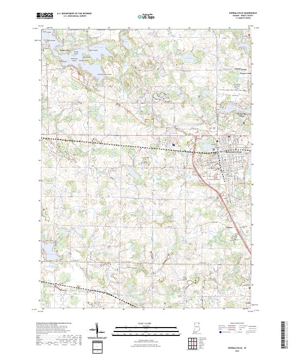
2022 Map of Kendallville
USGS Topo · Published 2022About this map
Sylvan Lake serves as a geographic anchor in the northwest, dotted with named landforms like Big Island, Bishop Island, and the humorously titled Chicken Coop Island. The surrounding landscape is defined by an intricate network of drainage ditches including Oviatt Ditch and Waterhouse Ditch, which manage the low-lying terrain between smaller water bodies like Latta Lake and Munk Lake. Near Rome City, the Ft. Wayne to Kendallville Rail Trl follows a historic corridor that once connected these northern Indiana communities to the regional hub of Fort Wayne.
Find a feature on this map
103 named features on this map. Tap any name to fly to it.
Don’t see what you’re looking for? This feature index may not catch every label — zoom into the map to look around manually.
Map Details
Editions of this 2022 Kendallville Map
This is the sole edition of this map. No revisions or reprints were ever made.
Other maps of this area

1942 · Stroh
USGS Topo · 1:24,000

1947 · Wolcottville
USGS Topo · 1:24,000

1947 · Oliver Lake
USGS Topo · 1:24,000

1951 · Merriam
USGS Topo · 1:24,000

1953 · Fort Wayne
USGS Topo · 1:250,000

1955 · Corunna
USGS Topo · 1:24,000

1955 · Ege
USGS Topo · 1:24,000

1955 · Kendallville
USGS Topo · 1:24,000

1956 · Fort Wayne
USGS Topo · 1:250,000

1956 · Albion
USGS Topo · 1:24,000