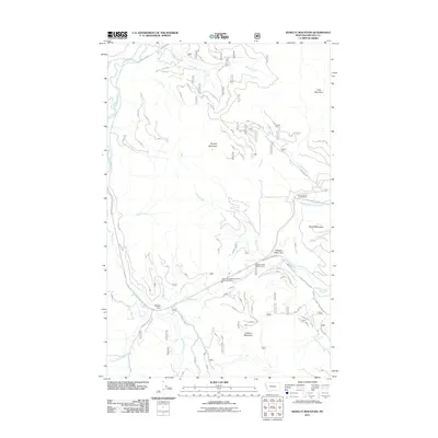
2011 Map of Kenelty Mountain
USGS Topo · Published 2011About this map
Kenelty Mountain and Wapiti Mountain define the high terrain of this Lincoln County corridor, where the Fisher River and its various forks dictate the path of local infrastructure. The landscape is marked by a complex network of forest roads like FDR 6732 and FDR 6722, which trace the drainages of Smoke Creek and Crystal Creek. The southern portion of the map shows a concentrated area of public activity near Sedlak Park and Pleasant Valley Park. Essential local services are represented by the Fisher River Valley Fire and Rescue Battalion 2, situated along the Pleasant Valley Fisher River. For those tracing historical transit, the presence of Old US Hwy 2 South offers a look at earlier transportation routes through this mountain valley before modern realignments.
Find a feature on this map
31 named features on this map. Tap any name to fly to it.
Don’t see what you’re looking for? This feature index may not catch every label — zoom into the map to look around manually.
Map Details
Editions of this 2011 Kenelty Mountain Map
This is the sole edition of this map. No revisions or reprints were ever made.
Other maps of this area

1920 · Jennings
USGS Topo · 1:125,000

1935 · Thompson Lakes
USGS Topo · 1:96,000

1937 · Thompson Falls
USGS Topo · 1:125,000

1942 · Thompson Lakes
USGS Topo · 1:125,000

1956 · Wallace
USGS Topo · 1:250,000

1957 · Kalispell
USGS Topo · 1:250,000

1960 · Kalispell
USGS Topo · 1:250,000

1960 · Wallace
USGS Topo · 1:250,000

1961 · Kalispell
USGS Topo · 1:250,000
1966 · Horse Mountain
USGS Topo · 1:24,000