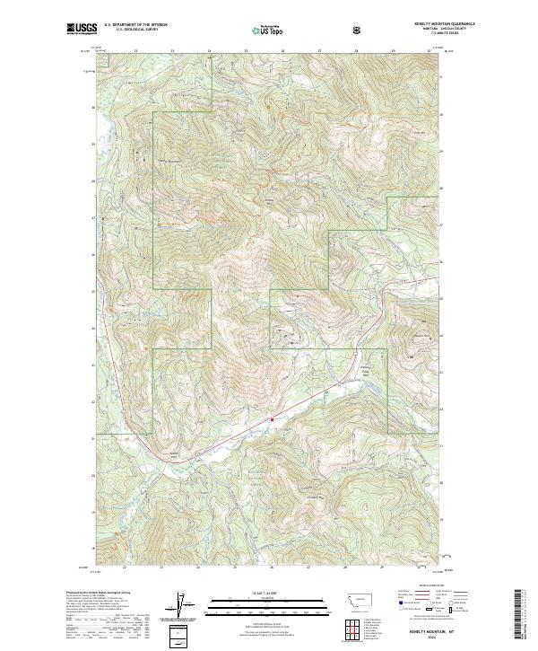
2024 Map of Kenelty Mountain
USGS Topo · Published 2024About this map
The Kootenai National Forest dominates this section of Lincoln County, defined by a network of drainage basins and high summits within the Cabinet Mountains. The landscape is centered on Kenelty Mtn, where numerous forest development routes and historical paths such as the Smoke Creek Trl and Divide Trail 6 converge. The Fisher River and its various forks, including the Pleasant Valley Fisher River and Silver Butte Fisher River, dictate the low-lying topography where human transit is most concentrated. Old US Hwy 2 and Silver Butte Rd follow these natural water-carved corridors, providing access to remote recreational spots like Sedlak Park and Pleasant Valley Park. This map documents a modern snapshot of a region still defined by its complex timber and watershed management systems.
Find a feature on this map
40 named features on this map. Tap any name to fly to it.
Don’t see what you’re looking for? This feature index may not catch every label — zoom into the map to look around manually.
Map Details
Editions of this 2024 Kenelty Mountain Map
This is the sole edition of this map. No revisions or reprints were ever made.
Other maps of this area

1920 · Jennings
USGS Topo · 1:125,000

1935 · Thompson Lakes
USGS Topo · 1:96,000

1937 · Thompson Falls
USGS Topo · 1:125,000

1942 · Thompson Lakes
USGS Topo · 1:125,000

1956 · Wallace
USGS Topo · 1:250,000

1957 · Kalispell
USGS Topo · 1:250,000

1960 · Kalispell
USGS Topo · 1:250,000

1960 · Wallace
USGS Topo · 1:250,000

1961 · Kalispell
USGS Topo · 1:250,000
1966 · Horse Mountain
USGS Topo · 1:24,000