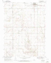
1969 Map of Kenesaw
USGS Topo · Published 1972About this map
Kenesaw sits at the intersection of agricultural transport and local community life in this late 1960s survey. The Burlington Northern railroad cuts across the northern landscape, anchoring the town’s position as a rural hub. Beyond the village limits, the terrain is defined by the winding course of Cottonwood Creek and a network of section lines that mark the township boundaries of Lowell, Kenesaw, and Wanda. This area is particularly rich in local historical markers, including the Kenesaw Cem, Shiloh Cem, and Zion Ch, reflecting the deep-rooted settlement patterns of the Nebraska plains. Further evidence of early pioneers can be found in the solitary Grave marked near the center of the sheet, while industrial activity is noted at a Sandpit situated along the creek’s path.
Find a feature on this map
17 named features on this map. Tap any name to fly to it.
Don’t see what you’re looking for? This feature index may not catch every label — zoom into the map to look around manually.
Map Details
Editions of this 1969 Kenesaw Map
This is the sole edition of this map. No revisions or reprints were ever made.
Other maps of this area

1894 · Kenesaw
USGS Topo · 1:62,500

1894 · Minden
USGS Topo · 1:62,500

1896 · Wood River
USGS Topo · 1:125,000

1897 · Red Cloud
USGS Topo · 1:125,000

1955 · Grand Island
USGS Topo · 1:250,000

1957 · Grand Island
USGS Topo · 1:250,000

1958 · Grand Island
USGS Topo · 1:250,000

1962 · Denman
USGS Topo · 1:24,000

1962 · Prosser
USGS Topo · 1:24,000
1962 · Gibbon South
USGS Topo · 1:24,000