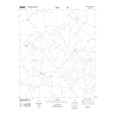
2010 Map of Kennard NE
USGS Topo · Published 2010About this map
The Neches River winds through this East Texas landscape, defining a region characterized by small rural settlements and numerous family burial grounds. Centered around Sweet Union, Plain, and Mount Vernon, the map reveals a community deeply rooted in its local geography. Genealogists will find significant value in the documentation of several family and community graveyards, including the McKinney and Wells Family Cemetery, Walker Cemetery, and Durham Cemetery. The presence of the Malibu Club Dam on Conner Creek and crossings like Ernest Anderson Crossing reflect the local interaction with the river systems. Much of the western portion is managed through a network of forestry roads, including Big Slough Wilderness Rd, while the Mouth of Hickory Creek Campground serves as a notable landmark where Hickory Creek meets the Neches.
Find a feature on this map
53 named features on this map. Tap any name to fly to it.
Don’t see what you’re looking for? This feature index may not catch every label — zoom into the map to look around manually.
Map Details
Editions of this 2010 Kennard NE Map
This is the sole edition of this map. No revisions or reprints were ever made.
Other maps of this area

1946 · Alto
USGS Topo · 1:62,500

1950 · Kennard NE
USGS Topo · 1:24,000

1950 · Ratcliff
USGS Topo · 1:24,000

1950 · Centralia
USGS Topo · 1:24,000

1951 · Kennard
USGS Topo · 1:24,000

1951 · Wells
USGS Topo · 1:24,000

1951 · Wells SW
USGS Topo · 1:24,000

1951 · Centralia
USGS Topo · 1:24,000

1951 · Kennard NE
USGS Topo · 1:24,000

1951 · Ratcliff
USGS Topo · 1:24,000