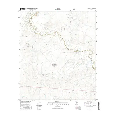
2016 Map of Kennard NE
USGS Topo · Published 2016About this map
The Neches River meanders across this East Texas landscape, forming a natural boundary between Houston, Cherokee, and Angelina counties. Much of the terrain is protected within the Davy Crockett National Forest, where a network of forest roads and creek systems like Sikes Cr and Larrison Cr define the rural character. This area is notably dense with small family and community burial sites, suggesting a deep history of early settlement and private homesteading. Of particular interest to local historians is the Mexican Prisoners Grave located near the river, a site that provides a somber connection to the region's 19th-century history. Genealogists will find several family-named landmarks including McKinney and Wells Family Cem and Walker Cem, while the presence of Malibu Club Lake indicates more modern recreational development along the river's edge.
Find a feature on this map
50 named features on this map. Tap any name to fly to it.
Don’t see what you’re looking for? This feature index may not catch every label — zoom into the map to look around manually.
Map Details
Editions of this 2016 Kennard NE Map
This is the sole edition of this map. No revisions or reprints were ever made.
Other maps of this area

1946 · Alto
USGS Topo · 1:62,500

1950 · Kennard NE
USGS Topo · 1:24,000

1950 · Ratcliff
USGS Topo · 1:24,000

1950 · Centralia
USGS Topo · 1:24,000

1951 · Kennard
USGS Topo · 1:24,000

1951 · Wells
USGS Topo · 1:24,000

1951 · Wells SW
USGS Topo · 1:24,000

1951 · Centralia
USGS Topo · 1:24,000

1951 · Kennard NE
USGS Topo · 1:24,000

1951 · Ratcliff
USGS Topo · 1:24,000