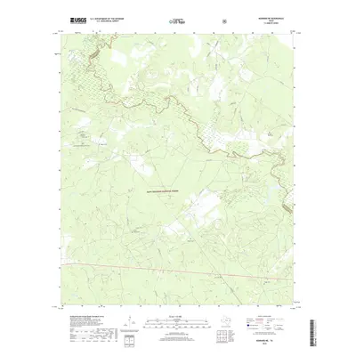
2019 Map of Kennard NE
USGS Topo · Published 2019About this map
The Neches River snakes across this East Texas landscape, forming a natural boundary between Cherokee and Houston counties within the Davy Crockett National Forest. This 2019 survey documents a region defined by its dense hydrology and preservation of local history. Genealogical researchers will find numerous small burial sites scattered across the woodland, including the McKinney and Wells Family Cem and the Walker Cem. A particularly distinct historical landmark, the Mexican Prisoners Grave, is located near Big Slough Wilderness Rd. The terrain is deeply incised by a network of waterways like Larrison Cr and Sikes Cr, while McCall Lake sits in the northwestern corner. The map also captures the meeting point of Angelina and Houston counties along the river's bend, illustrating how these old watercourses continue to dictate modern administrative boundaries.
Find a feature on this map
49 named features on this map. Tap any name to fly to it.
Don’t see what you’re looking for? This feature index may not catch every label — zoom into the map to look around manually.
Map Details
Editions of this 2019 Kennard NE Map
This is the sole edition of this map. No revisions or reprints were ever made.
Other maps of this area

1946 · Alto
USGS Topo · 1:62,500

1950 · Kennard NE
USGS Topo · 1:24,000

1950 · Ratcliff
USGS Topo · 1:24,000

1950 · Centralia
USGS Topo · 1:24,000

1951 · Kennard
USGS Topo · 1:24,000

1951 · Wells
USGS Topo · 1:24,000

1951 · Wells SW
USGS Topo · 1:24,000

1951 · Centralia
USGS Topo · 1:24,000

1951 · Kennard NE
USGS Topo · 1:24,000

1951 · Ratcliff
USGS Topo · 1:24,000