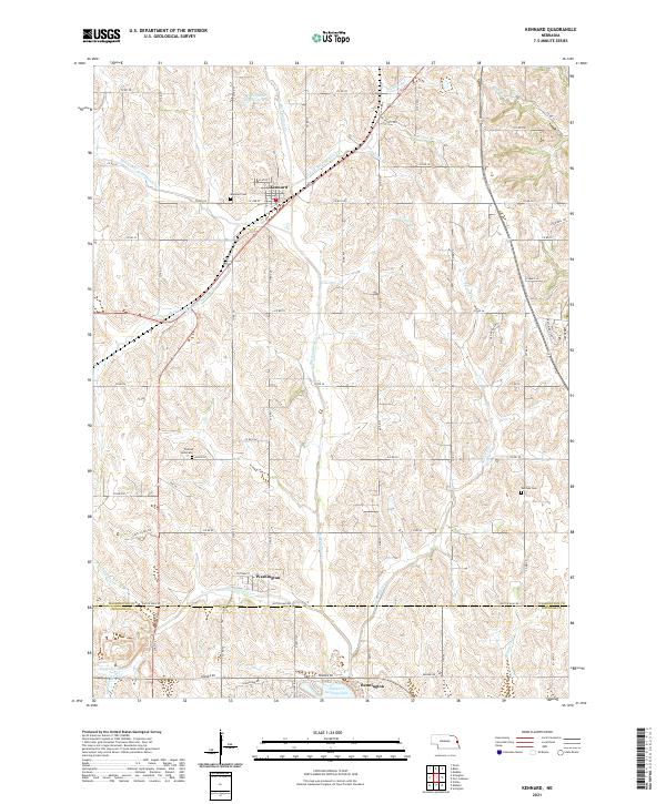
2021 Map of Kennard
USGS Topo · Published 2021About this map
The headwaters of Big Papillion Cr dominate this landscape north of the Washington and Douglas County line. This region is defined by a dense network of tributaries, including Butter Flat Cr and Falls Br, which carve through the agricultural uplands. The settlement of Kennard serves as a local hub in the northern section, while the southern edge of the map shows the expansion of Bennington near the shores of Newport Landing Lake.
Find a feature on this map
69 named features on this map. Tap any name to fly to it.
Don’t see what you’re looking for? This feature index may not catch every label — zoom into the map to look around manually.
Map Details
Editions of this 2021 Kennard Map
This is the sole edition of this map. No revisions or reprints were ever made.
Other maps of this area

1893 · Fremont
USGS Topo · 1:125,000

1896 · Fremont
USGS Topo · 1:125,000

1955 · Fremont
USGS Topo · 1:250,000

1956 · Irvington
USGS Topo · 1:24,000

1957 · Fremont
USGS Topo · 1:250,000

1958 · Fremont
USGS Topo · 1:250,000

1968 · Valley
USGS Topo · 1:24,000

1968 · Kennard
USGS Topo · 1:24,000
1968 · Arlington
USGS Topo · 1:24,000
1968 · Fort Calhoun
USGS Topo · 1:24,000