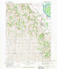
1968 Map of Fort Calhoun
USGS Topo · Published 1971About this map
Fort Calhoun sits on the bluffs overlooking the wide Missouri River valley, serving as a focal point for this 1968 landscape. The geography is defined by the sharp transition from the loess hills of Washington County to the floodplains of the De Soto National Wildlife Refuge. This era captures a rural network of one-room schoolhouses still marked on the landscape, such as School No 8 and the Wranck Sch, alongside early aviation features like the Bil-Lo Landing Strip and Flightland Airport.
Find a feature on this map
36 named features on this map. Tap any name to fly to it.
Don’t see what you’re looking for? This feature index may not catch every label — zoom into the map to look around manually.
Map Details
Editions of this 1968 Fort Calhoun Map
2 editions found
Other maps of this area

1893 · Omaha
USGS Topo · 1:62,500

1893 · Fremont
USGS Topo · 1:125,000

1896 · Fremont
USGS Topo · 1:125,000

1954 · Omaha
USGS Topo · 1:250,000

1955 · Fremont
USGS Topo · 1:250,000

1956 · Irvington
USGS Topo · 1:24,000

1956 · Omaha North
USGS Topo · 1:24,000

1957 · Fremont
USGS Topo · 1:250,000

1957 · Omaha
USGS Topo · 1:250,000

1957 · Loveland
USGS Topo · 1:24,000