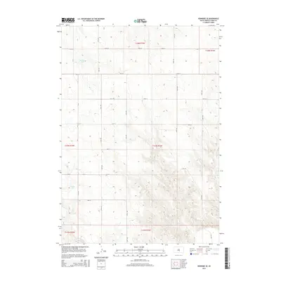
2015 Map of Kennebec SE
USGS Topo · Published 2015About this map
Kennebec Lake and Jackson Lake anchor the northwestern portion of this Lyman County landscape, which reflects the systematic grid of the Public Land Survey System. The terrain is defined by a series of north-south and east-west rural roads, including CR-19 and 244th St, that partition the prairie into sections for agricultural use. In the southeastern corner, the drainage of Bad Cr introduces more complex topography where the level plains transition into a series of draws and ridges. This 2015 survey provides a clear view of the modern rural infrastructure in this part of South Dakota, showing how local access via routes like 319th Ave and 250th St connects the scattered homesteads and water resources that sustain the region's ranching and farming economy.
Find a feature on this map
22 named features on this map. Tap any name to fly to it.
Don’t see what you’re looking for? This feature index may not catch every label — zoom into the map to look around manually.
Map Details
Editions of this 2015 Kennebec SE Map
This is the sole edition of this map. No revisions or reprints were ever made.
Other maps of this area

1951 · Ideal NW
USGS Topo · 1:24,000

1951 · Ideal NE
USGS Topo · 1:24,000

1952 · Reliance SW
USGS Topo · 1:24,000

1952 · Hamill NW
USGS Topo · 1:24,000

1955 · Mitchell
USGS Topo · 1:250,000

1959 · Mitchell
USGS Topo · 1:250,000
1978 · Brakke Dam
USGS Topo · 1:24,000
1978 · Lyman
USGS Topo · 1:24,000

1978 · Kennebec SW
USGS Topo · 1:24,000
1978 · Kennebec SE
USGS Topo · 1:24,000