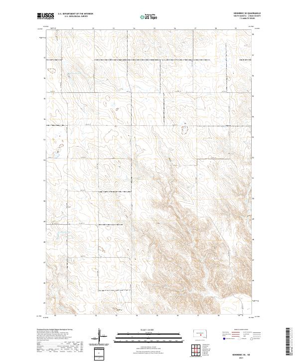
2021 Map of Kennebec SE
USGS Topo · Published 2021About this map
Kennebec Lake and Jackson Lake anchor this rural landscape in south-central South Dakota, where the drainage patterns of Navis Cr and Bad Cr carve into the prairie. The map reveals a strictly regulated township and range system, with gravel and dirt roads like 315th Ave and 319 Th Ave following section lines with geometric precision. This grid is interrupted only by the natural contours of the draws and the scattered seasonal wetlands that dot the plains.
Find a feature on this map
25 named features on this map. Tap any name to fly to it.
Don’t see what you’re looking for? This feature index may not catch every label — zoom into the map to look around manually.
Map Details
Editions of this 2021 Kennebec SE Map
This is the sole edition of this map. No revisions or reprints were ever made.
Other maps of this area

1951 · Ideal NW
USGS Topo · 1:24,000

1951 · Ideal NE
USGS Topo · 1:24,000

1952 · Reliance SW
USGS Topo · 1:24,000

1952 · Hamill NW
USGS Topo · 1:24,000

1955 · Mitchell
USGS Topo · 1:250,000

1959 · Mitchell
USGS Topo · 1:250,000
1978 · Brakke Dam
USGS Topo · 1:24,000
1978 · Lyman
USGS Topo · 1:24,000

1978 · Kennebec SW
USGS Topo · 1:24,000
1978 · Kennebec SE
USGS Topo · 1:24,000