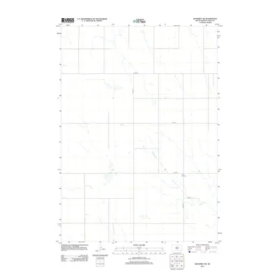
2012 Map of Kennebec SW
USGS Topo · Published 2012About this map
Prairie View Cem stands as a quiet focal point in this section of Lyman County, situated near the intersection of 313th Ave and 249th St. The surrounding landscape is defined by the intermittent drainage of Davis Cr, which meanders southeastward through a terrain marked by small prairie basins and wetlands. This 2012 survey illustrates a sparse ranching and agricultural grid typical of central South Dakota, where travel relies on a network of graded county roads such as CO Hwy-23 and CO Hwy-17. The absence of large-scale development preserves the traditional section lines and rural character of the Great Plains, offering researchers a clear look at the land's hydrology and modern infrastructure layout prior to further land-use changes.
Find a feature on this map
8 named features on this map. Tap any name to fly to it.
Don’t see what you’re looking for? This feature index may not catch every label — zoom into the map to look around manually.
Map Details
Editions of this 2012 Kennebec SW Map
This is the sole edition of this map. No revisions or reprints were ever made.
Other maps of this area

1951 · Presho 4 NE
USGS Topo · 1:24,000

1951 · Ideal NW
USGS Topo · 1:24,000

1951 · Ideal NE
USGS Topo · 1:24,000

1955 · Martin
USGS Topo · 1:250,000

1955 · Mitchell
USGS Topo · 1:250,000

1958 · Martin
USGS Topo · 1:250,000

1959 · Mitchell
USGS Topo · 1:250,000
1978 · Presho
USGS Topo · 1:24,000
1978 · Brakke Dam
USGS Topo · 1:24,000

1978 · Kennebec SW
USGS Topo · 1:24,000