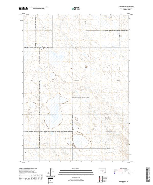
2021 Map of Kennebec SW
USGS Topo · Published 2021About this map
Prairie View Cem. serves as a primary historical landmark in this section of Lyman County, positioned alongside 249th St. The landscape is characterized by its agricultural organization, defined by a rigid grid of local thoroughfares such as 312th Ave and 309th Ave that facilitate movement through the rural plains. Drainage across the territory is managed by Davis Cr, which meanders through several sections, providing a natural break in the surveyed township lines. The network of county routes, including Co Hwy 17 and Co Hwy 23, illustrates the modern infrastructure supporting this prairie region. The arrangement of these roads and water features reflects a long-standing pattern of land division and rural habitation in central South Dakota.
Find a feature on this map
24 named features on this map. Tap any name to fly to it.
Don’t see what you’re looking for? This feature index may not catch every label — zoom into the map to look around manually.
Map Details
Editions of this 2021 Kennebec SW Map
This is the sole edition of this map. No revisions or reprints were ever made.
Other maps of this area

1951 · Presho 4 NE
USGS Topo · 1:24,000

1951 · Ideal NW
USGS Topo · 1:24,000

1951 · Ideal NE
USGS Topo · 1:24,000

1955 · Martin
USGS Topo · 1:250,000

1955 · Mitchell
USGS Topo · 1:250,000

1958 · Martin
USGS Topo · 1:250,000

1959 · Mitchell
USGS Topo · 1:250,000
1978 · Presho
USGS Topo · 1:24,000
1978 · Brakke Dam
USGS Topo · 1:24,000

1978 · Kennebec SW
USGS Topo · 1:24,000