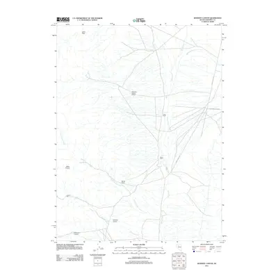
2011 Map of Kennedy Canyon
USGS Topo · Published 2011About this map
The high desert landscape of Pershing County, Nevada, is defined by a complex network of seasonal drainages and isolated agricultural holdings in this 2011 survey. Centered on the eastern reaches of the county, the area features the Imperial Mill and established homesteads like Guthrie Ranch and Sarret Ranch situated along the base of the mountains. The map illustrates the convergence of several significant canyons and gulches, including Kennedy Canyon, Sweeney Garden Canyon, and Spring Gulch, which channel water toward the valley floor through Spring Creek and North Cinnabar Creek. The transport network is anchored by S Grass Valley Rd and the Golconda-Canyon Rd, providing critical access across the arid terrain of Johns Basin. This modern topographic study preserves the naming conventions and geographic markers of a remote ranching and mining district.
Find a feature on this map
16 named features on this map. Tap any name to fly to it.
Don’t see what you’re looking for? This feature index may not catch every label — zoom into the map to look around manually.
Map Details
Editions of this 2011 Kennedy Canyon Map
This is the sole edition of this map. No revisions or reprints were ever made.
Other maps of this area

1932 · Sonoma Range
USGS Topo · 1:250,000

1939 · Sonoma Range
USGS Topo · 1:250,000

1955 · Winnemucca
USGS Topo · 1:250,000

1958 · Winnemucca
USGS Topo · 1:250,000
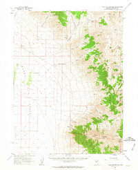
1961 · Kyle Hot Springs
USGS Topo · 1:62,500

1961 · Mt. Tobin
USGS Topo · 1:62,500

1961 · Cain Mountain
USGS Topo · 1:62,500

1961 · Fencemaker
USGS Topo · 1:62,500

1962 · Winnemucca
USGS Topo · 1:250,000

1982 · Fish Creek Mts
USGS Topo · 1:100,000