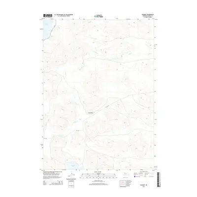
2014 Map of Kennedy
USGS Topo · Published 2014About this map
Kennedy and the surrounding ranching country of Cherry County are defined by the intricate hydrology of the Sandhills region. The winding course of Gordon Cr meanders across the landscape, eventually meeting the expansive Merritt Reservoir in the northwestern corner of the quadrangle. This 2014 survey illustrates a geography shaped by water management and transit, where Lone Tree Lake provides a distinct landmark amidst the undulating terrain. Transportation through this part of the Nebraska backcountry is anchored by Ne-97 and the specific local connectivity provided by 16B Spur, which links the small settlement of Kennedy to the broader regional network. The map reveals the relationship between these remote outposts and the essential water resources that sustain the area's agricultural life.
Find a feature on this map
7 named features on this map. Tap any name to fly to it.
Don’t see what you’re looking for? This feature index may not catch every label — zoom into the map to look around manually.
Map Details
Editions of this 2014 Kennedy Map
This is the sole edition of this map. No revisions or reprints were ever made.
Other maps of this area

1950 · Simeon
USGS Topo · 1:62,500

1950 · Kennedy
USGS Topo · 1:62,500

1951 · Bull Lake
USGS Topo · 1:62,500

1951 · Brownlee
USGS Topo · 1:62,500

1957 · Valentine
USGS Topo · 1:250,000

1959 · Valentine
USGS Topo · 1:250,000

1985 · Goose Creek
USGS Topo · 1:100,000
1985 · Windmill Lake
USGS Topo · 1:24,000

1985 · Valentine
USGS Topo · 1:100,000
1985 · Snake River Falls
USGS Topo · 1:24,000