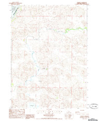
1985 Map of Kennedy
USGS Topo · Published 1985About this map
Kennedy stands as a small center of settlement in this northern Nebraska landscape, documented during the mid-1980s. The area is defined by the winding course of Gordon Creek and the southern reaches of the Merritt Reservoir, which occupies the northwestern corner of the quadrangle. This territory is largely dedicated to conservation and recreation, notably within the Merritt Reservoir State Wildlife Management Area. The map reveals a sparsely populated region of the Sandhills, where ranching life and geography are tied to isolated water sources like Lone Tree Lake. Further south, the curiously named Tiny Town appears as a distinct point of interest amidst the rolling terrain, illustrating the pattern of small, localized clusters that characterize this part of Cherry County.
Find a feature on this map
9 named features on this map. Tap any name to fly to it.
Don’t see what you’re looking for? This feature index may not catch every label — zoom into the map to look around manually.
Map Details
Editions of this 1985 Kennedy Map
This is the sole edition of this map. No revisions or reprints were ever made.
Other maps of this area

1950 · Simeon
USGS Topo · 1:62,500

1950 · Kennedy
USGS Topo · 1:62,500

1951 · Bull Lake
USGS Topo · 1:62,500

1951 · Brownlee
USGS Topo · 1:62,500

1957 · Valentine
USGS Topo · 1:250,000

1959 · Valentine
USGS Topo · 1:250,000

1985 · Goose Creek
USGS Topo · 1:100,000
1985 · Windmill Lake
USGS Topo · 1:24,000

1985 · Valentine
USGS Topo · 1:100,000
1985 · Snake River Falls
USGS Topo · 1:24,000