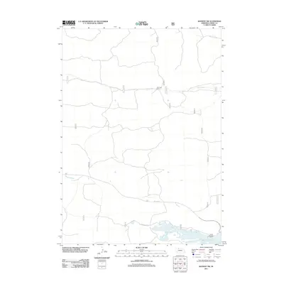
2011 Map of Kennedy NW
USGS Topo · Published 2011About this map
Merritt Reservoir dominates the southern landscape of this Cherry County quadrangle, where the expansive shoreline and nearby Powder Horn Area Campground suggest a hub for outdoor activity and land management in the Nebraska Sandhills. The northern half is defined by the winding course of Steer Creek, which flows eastward through a series of valleys flanked by ranch roads and fire access routes. Notable backcountry destinations like Steer Creek Camp are connected by a network of numbered trails and roads, including the Powderhorn Trl and the 16F to 97 Rd. This 2011 survey illustrates the sparse, high-plains infrastructure where water resources and primitive roads dictate the movement across the terrain.
Find a feature on this map
10 named features on this map. Tap any name to fly to it.
Don’t see what you’re looking for? This feature index may not catch every label — zoom into the map to look around manually.
Map Details
Editions of this 2011 Kennedy NW Map
This is the sole edition of this map. No revisions or reprints were ever made.
Other maps of this area

1950 · Powderhorn Valley
USGS Topo · 1:62,500

1950 · Kennedy
USGS Topo · 1:62,500

1950 · Kilgore
USGS Topo · 1:62,500

1950 · Cody
USGS Topo · 1:62,500

1957 · Valentine
USGS Topo · 1:250,000

1959 · Valentine
USGS Topo · 1:250,000
1985 · Kilgore SE
USGS Topo · 1:24,000

1985 · Cooper Canyon
USGS Topo · 1:24,000
1985 · Cody SE
USGS Topo · 1:24,000

1985 · Cody
USGS Topo · 1:100,000