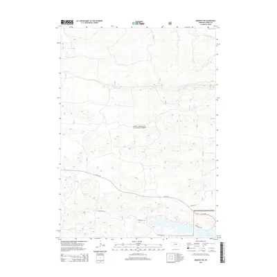
2014 Map of Kennedy NW
USGS Topo · Published 2014About this map
Sam R. McKelvie National Forest dominates this section of the Nebraska Sandhills, a landscape characterized by its intricate topography and delicate water systems. The northern portion of the map is defined by the meandering course of Steer Cr, while the southern reaches reveal the northern extent of the Merritt Reservoir. This 2014 survey documents the established network of forest roads and trails that provide access through the undulating terrain, including the Powderhorn Trl and Powder Finger Trl. The primary transit corridor, 16F To 97 Rd, cuts across the lower half of the quadrangle, serving as a vital connection point for this protected natural area. The layout of these trails and roads highlights how the region has been managed for both conservation and controlled access within the larger forest system.
Find a feature on this map
10 named features on this map. Tap any name to fly to it.
Don’t see what you’re looking for? This feature index may not catch every label — zoom into the map to look around manually.
Map Details
Editions of this 2014 Kennedy NW Map
This is the sole edition of this map. No revisions or reprints were ever made.
Other maps of this area

1950 · Powderhorn Valley
USGS Topo · 1:62,500

1950 · Kennedy
USGS Topo · 1:62,500

1950 · Kilgore
USGS Topo · 1:62,500

1950 · Cody
USGS Topo · 1:62,500

1957 · Valentine
USGS Topo · 1:250,000

1959 · Valentine
USGS Topo · 1:250,000
1985 · Kilgore SE
USGS Topo · 1:24,000

1985 · Cooper Canyon
USGS Topo · 1:24,000
1985 · Cody SE
USGS Topo · 1:24,000

1985 · Cody
USGS Topo · 1:100,000