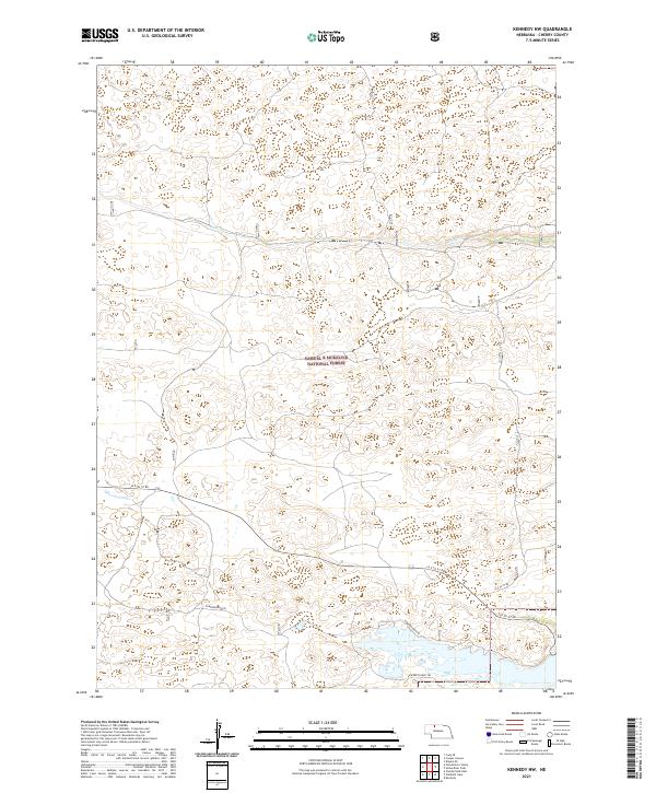
2021 Map of Kennedy NW
USGS Topo · Published 2021About this map
Samuel R McKelvie National Forest dominates this section of the Nebraska Sandhills, showcasing a landscape of complex dune topography and scattered wetlands. The map details a largely roadless interior, where movement is dictated by historic paths like the Powderhorn Trl and Powder Finger Trl. This area represents the unique High Plains ecosystem, where the water table frequently meets the surface to create small, unnamed basins amongst the hills.
Find a feature on this map
9 named features on this map. Tap any name to fly to it.
Don’t see what you’re looking for? This feature index may not catch every label — zoom into the map to look around manually.
Map Details
Editions of this 2021 Kennedy NW Map
This is the sole edition of this map. No revisions or reprints were ever made.
Other maps of this area

1950 · Powderhorn Valley
USGS Topo · 1:62,500

1950 · Kennedy
USGS Topo · 1:62,500

1950 · Kilgore
USGS Topo · 1:62,500

1950 · Cody
USGS Topo · 1:62,500

1957 · Valentine
USGS Topo · 1:250,000

1959 · Valentine
USGS Topo · 1:250,000
1985 · Kilgore SE
USGS Topo · 1:24,000

1985 · Cooper Canyon
USGS Topo · 1:24,000
1985 · Cody SE
USGS Topo · 1:24,000

1985 · Cody
USGS Topo · 1:100,000