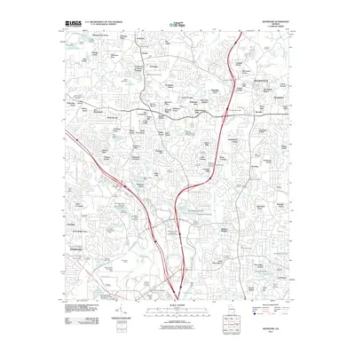
2011 Map of Kennesaw
USGS Topo · Published 2011About this map
Woodstock and Kennesaw anchor this detailed study of Cobb and Cherokee Counties, showing a suburban landscape defined by a dense network of residential developments and historic transportation corridors. The map records the expansion of Kennesaw State University and the industrial footprint of the Kennesaw Quarry, alongside recreational sites like the Dixie Speedway. Significant genealogical resources are documented throughout the drainage basins of Noonday Creek and Kellogg Creek, including many family and community burial grounds such as Sardis Cemetery, Ponder Cemetery, and the Franklin-Hamilton Cemetery.
Find a feature on this map
171 named features on this map. Tap any name to fly to it.
Don’t see what you’re looking for? This feature index may not catch every label — zoom into the map to look around manually.
Map Details
Editions of this 2011 Kennesaw Map
This is the sole edition of this map. No revisions or reprints were ever made.
Other maps of this area

1888 · Atlanta
USGS Topo · 1:125,000

1890 · Suwanee
USGS Topo · 1:125,000

1890 · Cartersville
USGS Topo · 1:125,000

1890 · Atlanta
USGS Topo · 1:125,000

1891 · Marietta
USGS Topo · 1:125,000

1891 · Cartersville
USGS Topo · 1:125,000

1892 · Atlanta
USGS Topo · 1:125,000

1894 · Suwanee
USGS Topo · 1:125,000

1895 · Atlanta
USGS Topo · 1:125,000

1895 · Marietta
USGS Topo · 1:125,000