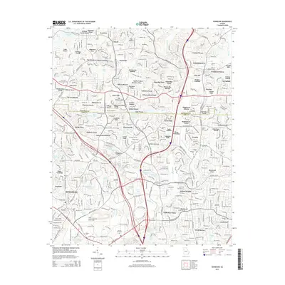
2014 Map of Kennesaw
USGS Topo · Published 2014About this map
The boundary between Cherokee Co and Cobb Co bisects a landscape defined by rapid suburban expansion and significant transportation corridors during the mid-2010s. The northern reaches of this area are shaped by the waters of Allatoona Lake and the strategic Allatoona Pass, while the southern portion transitions into the dense educational and aviation hub containing Kennesaw State Univ and the Cobb County Airport-Mc Collum Field. Numerous family and historic burial sites are preserved amidst the development, including Old Noonday Cem, Old Ebenezer Cem, and Blackwell Cem, offering vital touchstones for genealogists. The rail history of the region is anchored by Woodstock Station, while the intricate network of water bodies like Nelson Lake and Wooten Lake feed into the prominent Noonday Creek system.
Find a feature on this map
107 named features on this map. Tap any name to fly to it.
Don’t see what you’re looking for? This feature index may not catch every label — zoom into the map to look around manually.
Map Details
Editions of this 2014 Kennesaw Map
This is the sole edition of this map. No revisions or reprints were ever made.
Other maps of this area

1888 · Atlanta
USGS Topo · 1:125,000

1890 · Suwanee
USGS Topo · 1:125,000

1890 · Cartersville
USGS Topo · 1:125,000

1890 · Atlanta
USGS Topo · 1:125,000

1891 · Marietta
USGS Topo · 1:125,000

1891 · Cartersville
USGS Topo · 1:125,000

1892 · Atlanta
USGS Topo · 1:125,000

1894 · Suwanee
USGS Topo · 1:125,000

1895 · Atlanta
USGS Topo · 1:125,000

1895 · Marietta
USGS Topo · 1:125,000