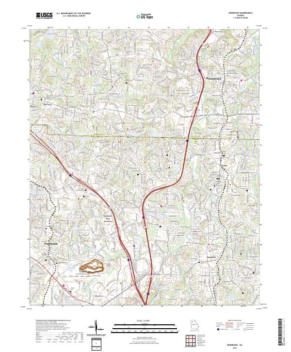
2024 Map of Kennesaw
USGS Topo · Published 2024About this map
The city of Kennesaw and the surrounding suburban expansion of Cobb County define this modern landscape, centered on the intersection of major transport corridors and educational institutions. The expansive campus of Kennesaw State University sits near the heart of the map, adjacent to I-75 and the industrial activity near the Cobb County International Airport/McCollum Field. The terrain is deeply carved by water, with Noonday Creek and Little Noonday Creek flowing through residential developments and golf courses like the Pinetree Country Club Lake.
Find a feature on this map
53 named features on this map. Tap any name to fly to it.
Don’t see what you’re looking for? This feature index may not catch every label — zoom into the map to look around manually.
Map Details
Editions of this 2024 Kennesaw Map
This is the sole edition of this map. No revisions or reprints were ever made.