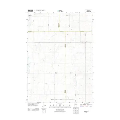
2013 Map of Kenneth
USGS Topo · Published 2013About this map
The elevated plateau of the Coteau des Prairies defines the topography of this southwestern Minnesota landscape, where the headwaters of the Rock River and Chanarambie Cr drain the high plains. The map illustrates a region of dispersed agricultural settlements and small rural centers during the early 21st century. The village of Kenneth sits at the junction of Co Hwy-3 and Co Hwy-9, while the community of Leota serves as a local hub further north, anchored by the Leota Cem and a local Po. The intricate grid of county roads, such as Co Hwy-10 and Birkett Ave, underscores the region's organized land division. This survey captures the intersection of four counties—Pipestone, Rock, Murray, and Nobles—reflecting the jurisdictional complexity of this rural corner of the state.
Find a feature on this map
43 named features on this map. Tap any name to fly to it.
Don’t see what you’re looking for? This feature index may not catch every label — zoom into the map to look around manually.
Map Details
Editions of this 2013 Kenneth Map
This is the sole edition of this map. No revisions or reprints were ever made.
Other maps of this area

1954 · Fairmont
USGS Topo · 1:250,000

1955 · Sioux Falls
USGS Topo · 1:250,000

1958 · Sioux Falls
USGS Topo · 1:250,000

1958 · Fairmont
USGS Topo · 1:250,000

1967 · Edgerton South
USGS Topo · 1:24,000

1967 · Slayton SW
USGS Topo · 1:24,000

1967 · Magnolia
USGS Topo · 1:24,000

1967 · Edgerton North
USGS Topo · 1:24,000

1967 · Edgerton NE
USGS Topo · 1:24,000

1967 · Kenneth
USGS Topo · 1:24,000