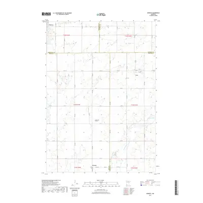
2019 Map of Kenneth
USGS Topo · Published 2019About this map
Edgerton stands at the northwestern corner of this agricultural landscape where the borders of Pipestone, Murray, Rock, and Nobles counties converge. The terrain is defined by the Coteau des Prairies, a prominent plateau that shapes the local drainage into waterways like Chanarambie Cr. This survey illustrates the rigid section-line grid of the Public Land Survey System, with a dense network of local roads such as Co HWY 1 and Abbott Ave connecting dispersed farmsteads. The small settlements of Leota and Kenneth serve as local hubs, with the Leota Cem providing a genealogical anchor for the surrounding community. The map preserves the exact layout of this rural prairie region, showing the relationship between small-town centers and the vast tillable acreage of southwestern Minnesota.
Find a feature on this map
59 named features on this map. Tap any name to fly to it.
Don’t see what you’re looking for? This feature index may not catch every label — zoom into the map to look around manually.
Map Details
Editions of this 2019 Kenneth Map
This is the sole edition of this map. No revisions or reprints were ever made.
Other maps of this area

1954 · Fairmont
USGS Topo · 1:250,000

1955 · Sioux Falls
USGS Topo · 1:250,000

1958 · Sioux Falls
USGS Topo · 1:250,000

1958 · Fairmont
USGS Topo · 1:250,000

1967 · Edgerton South
USGS Topo · 1:24,000

1967 · Slayton SW
USGS Topo · 1:24,000

1967 · Magnolia
USGS Topo · 1:24,000

1967 · Edgerton North
USGS Topo · 1:24,000

1967 · Edgerton NE
USGS Topo · 1:24,000

1967 · Kenneth
USGS Topo · 1:24,000